
- Forum
- Drakensberg Forum
- Drakensberg Hiking
- Traverses & Link-ups
- Monk's Cowl - Injisuthi link-up via escarpment
Monk's Cowl - Injisuthi link-up via escarpment
Rebecca wrote:
Thanks! (sorry, my question mark tab is broken)
See below. It's just shift and forward slash. Easy peasy.
From Nkosasana cave I'd head down Gray's Pass (be very sure to exit right out of that gulley about 50 vertical metres down and not like me and my mate going down at night...), then Keith Bush Camp/heading north around and back south via Blind Man's Corner on the contour. The going is quick along that contour up to Shada Ridge.
Please login or register to view the image attached to this post.
Please Log in or Create an account to join the conversation.
Your day 3 is quite easy as tiska indicates, and I would recommend on your way to Injisuthi Summit Cave you take the opportunity to explore and climb the Injisuthi Buttresses, and visit the Red Wall Falls. I have a write up on this in the thread "Injisuthi Area Summit Escarpment Exploration" from December 2013 which has some information on this. Search for this topic in the Google custom search box.
The route from Nkosazana Cave via Shada Ridge back to Injisuthi can be followed on the hiking map and would be: Descend Grays Pass passing Keith Bush Camp and following the path to Hlatikhulu Nek (M2 junction) and Blind Mans Corner (M3 junction), continue along the Contour Path to junction M4 where you turn off left and descend Shada Ridge, following the path. Towards junction M24 the path comes and goes a bit, and can be difficult to follow, but pass junctions M24 and M25, where you will pick up the strong path from Wonder Valley Cave and continue to the top of Van Heyningens Pass. Descend the pass, pass junction M26 which is not obvious at all, and at junction M28 turn left back to Injisuthi Camp, this is signposted.
Regarding the route description from Injisuthi Summit Cave to Nkosazana Cave, are you familiar with the area otherwise it will be very difficult to describe and follow?
Please Log in or Create an account to join the conversation.
- tonymarshall
-

- Offline
- VE Advisory
-

- Posts: 768
- Thank you received: 2233
Rebecca wrote: I am also struggling to find route descriptions for getting from Upper Injisuthi to Nkosasana cave. Do you have any thoughts on that
It is exactly as you say - when the mist comes in, it is very difficult to know where one is, and the weather is set to be very rainy.
You will know how to get back to the head of Leslie's pass from Upper Injisuthi Cave having done the walk a couple of days earlier. From the head of Leslie's Pass, follow the main river as it flows downhill due north for about 4 km. The river meanders before turning west and then south west. Leave the river before then and make your way up the long slope towards Champagne Castle. You'll need to read the map carefully for that section up the slope and on to the summit. The cave is about 15 to 20 minutes from the head of Grays Pass.
Please Log in or Create an account to join the conversation.
This is very useful. The morning are looking good so the plan is early starts to get a good grip of navigation before the mist rolls in, as it does.
So we will try to make our walk to Injisuthi cave a short day to maximise chances of finding the cave before the mist.
And we will descend via Gray's Pass, taking the (tricky to find) contour path which brings us back round to Blind Man's Corner and down Shada ridge. It seems the flags in terms of tricky navigation are
finding upper injasuthi cave
identifying the right steep slope as we approach nkosasana cave
and finding the contours veering to the right that links us back round to Shada ridge which we follow to Injasuthi camp
Hopefully the weather shows us mercy in the mornings! Thank you all for the advice and clarity, I appreciate it greatly!
Please Log in or Create an account to join the conversation.
make a difference. today.
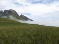
Please login or register to view the image attached to this post.
Please Log in or Create an account to join the conversation.
Do any of you have any advice on how to try and make sure we don't miss the contour path on our way back to Injasuti camp?! Down Gray's pass to relink up with Shada ridge.
Thank you for all the help, I am so appreciative.
Please Log in or Create an account to join the conversation.
Please Log in or Create an account to join the conversation.
- tonymarshall
-
- Offline
- VE Advisory
-
- Posts: 768
- Thank you received: 2233
Day 1: Starting at the Monks Cowl TH and traversing Shada Ridge via Contour Route to Injisuthi Camp
Day 2: Ascending Corner Pass
Day 3: Traverse to Grays Pass
Day 4: Descent back to Monks Cowl
I'm currently lodging in the Champagne Valley so drive time is minimal.
Any thoughts?
Cheers,
Ralph
Please Log in or Create an account to join the conversation.
- ralphcopeiv
-

- Offline
- New Member
-

- Posts: 8
- Thank you received: 11
The hard part of your proposed trip will be day 2: Injisuthi Camp to top of Corner Pass.
Probably better as 5 days unless everyone is up for an oppie-
Day 1: Starting at the Monks Cowl TH and traversing Shada Ridge via Contour Route to Injisuthi Camp
Day 2: Centenary Hut
Day 3: Ascendi Corner Pass
Day 4: Traverse to Grays Pass
Day 5: Descent back to Monks Cowl
An alternative is to start and finish at Injisuthi:
Day 1: Centenary
Day 2: Upper Injisuthi Cave via Corner Pass
Day 3: Descend Leslies
Day 4 Return Injisuthi
This misses out Grays Pass but that may not be a bad thing at the moment (see Berg alert thread). This route has a long thread on VE.
or
Day 1: Inj camp to Centenary
Day 2: Centenary to Upper Injisuthi Cave via Corner Pass
Day 3: Top Ships Prow
Day 4 Return Injisuthi
Day 4 will be the tester here. Shpis Prow has unfriendly bush at contour path level.
or
Day 1: Injisuthi Camp to Keith Bush
Day 2: Ascend Grays Pass
Day 3: to Leslies top
Day 4 Descend Leslies back to Inj Camp
This misses upper Injisuthi and Mafadi.
Please Log in or Create an account to join the conversation.
The other days are pretty normal hiking days as far as Berg hiking goes.
Please Log in or Create an account to join the conversation.

